The impressive Val Trippera
A nature walk suitable for everyone, which runs through a valley full of anecdotes and hidden treasures

The Feletto is the hilly terrain that surrounds the settlements of San Pietro Vecchio, Rua, Bagnolo, Santa Maria and San Michele di Feletto. It is mostly covered by vineyards of Conegliano Valdobbiadene Prosecco Superiore. This breathtaking landscape is dotted with ancient villages like Borgo Anese, whose name derives from the wool workers who lived here in ancient times, but also Borgo Castagnè and Borgo Frare. The area is a tapestry of small hills, flat areas, valleys, and ancient watermills turned by the Crevada stream that has carved out a small canyon, now known as Val Trippera. In this deep, secret and inhospitable defile, locals used to hide illicit stills to make grappa, but it was also an ideal place to get rid of the waste of unregistered slaughtered animals during the Venetian occupation. Trippe (Tripe) was thrown into the ravine in secret, hence the name Val Trippera. There is a circular walk of about seven kilometres that allows visitors to experience this place, offering enchanting views of the rural idyll in these historic villages. The very modest ascent makes this walk suitable for everyone.

The walk starts from Piazza Giovanni XXIII in San Pietro di Feletto and takes a country road that goes down through the vineyards, following the footpath sign Val Trippera n. 019 . It zigzags among the rows of grapevines, passing some uninhabited buildings, before reaching the valley floor near the source of the Cannelle stream. Here you turn left and enter the forest, which marks the real start of the walk. The scenery becomes increasingly fascinating as you enter the valley. The trail passes along the base of high conglomerate walls immersed in the vegetation, while the Crevada stream wends its way along the edge of the path: the atmosphere is truly impressive. At the end of the valley we meet the ruins of the ancient Mulino Crevada (Crevada waterwheel) and from here we follow a dirt road that leads to Borgo Anese, with its old country houses with their many courtyards and porticoes. The route now crosses the provincial road and follows via Salera until it reaches Borgo Castagnè. Continue on through some more vineyards and you will return to the starting point and the end of the walk at the Parish Church of San Pietro di Feletto.
Il Cristo della Domenica
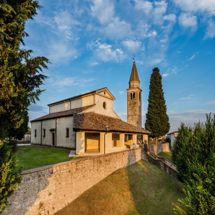
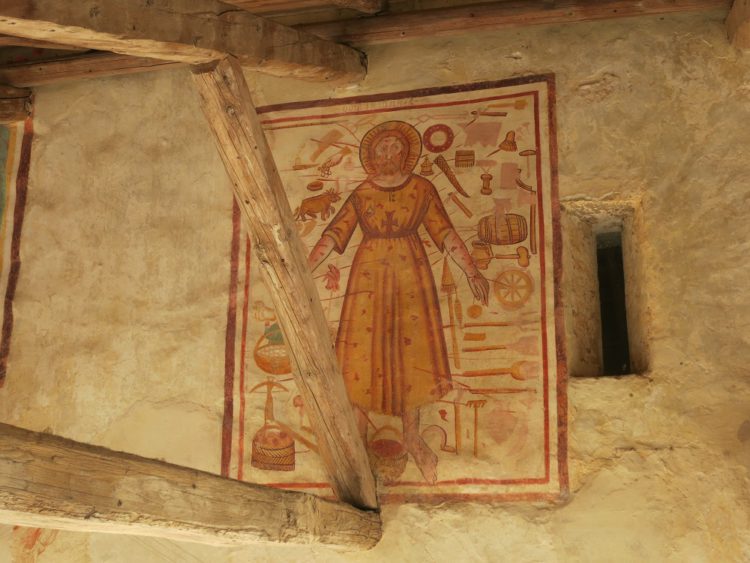
The Parish Church of San Pietro di Feletto is one of the most important religious buildings in the diocese of Vittorio Veneto. It was first documented in 1124, but it seems likely that it is much older. It was the cathedral of the old parishes of Santa Margherita di Refrontolo, Santa Maria di Feletto, San Dionigi di Collalbrigo, San Pancrazio di Formeniga among others, covering an area which took in the streams of Lierza, Monticano and Crevada. Inside, there is the baptismal chapel with a cycle of paintings dating from the fifteenth-century depicting the life of San Sebastiano, while in the external portico there is a famous painting entitled Il Cristo della Domenica, which was an iconographic theme common between the fourteenth and the sixteenth century but which ceased following the Council of Trento which imposed strict limitations on the use of sacred images and ordered its destruction.

Depicting Jesus surrounded by tools and objects related to daily work activities – hammers, scythes, axes and even oxen, barrels and bunches of grapes – the painting represents a strong warning (the tools cause wounds to the body of Christ) about the absolute prohibition of working on Sundays, a day dedicated to prayer. In Italy, very few images have survived, but some of these works may have been saved because some parish priests elected not defy the Council of Trento’s order. The image in San Pietro di Feletto is the only example in the province of Treviso, the fourth documented in the Tre Venezie together with the existing specimens in Tesero, Vicenza and Pordenone.
LA VAL TRIPPERA
THE ITINERARY IN DETAIL
Point of departure and arrival: San Pietro di Feletto, piazza Giovanni XXIII
Coordinates of starting and finishing point: 45°55’46.80″N 12°14’16.99″E
Time: 2h 30’
Total height gain: 220 m
Distance: 6,68 km
[This article was originally published in the Visit Conegliano Valdobbiadene magazine, issue Spring Summer 2018. The magazine is available here]